Derrynane Haus und Garten / Derrynane House and Gardens
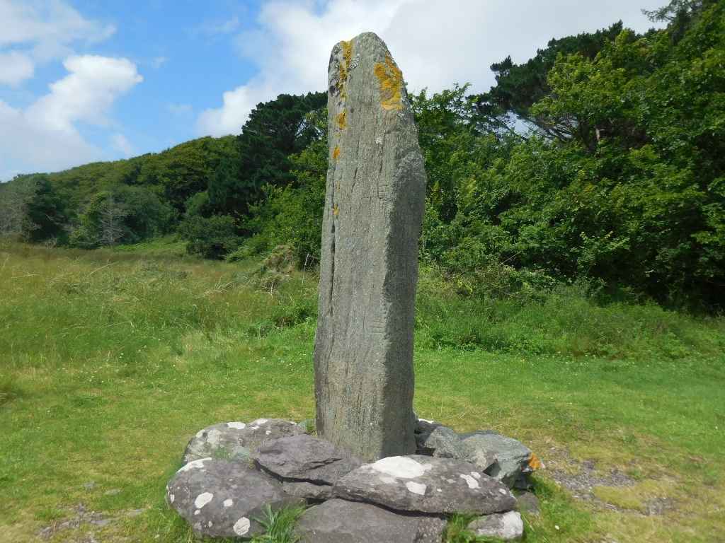
Ogham Stein / Ogham Stone
(2023-07-16)
Der Ogham Stein ist über 2 Meter hoch und wird auf das 6. Jahrhundert datiert. Er wurde in den 1940ern am Strand liegend gefunden und in der Nähe der Zufahrtsstraße wieder aufgestellt.
The Ogham stone is over 2 metres high and is dated to the 6th century. It was found lying on the beach in the 1940s and re-erected close to the access road.
Übersicht über Derrynane Haus und Garten / Overview of Derrynane House and Gardens

Zugeordnete Themen / Assigned Topics:
Mehr Informationen über - Ogham Stein / More information about - Ogham Stone
- en.wikipedia.org/wiki/Darrynane_Beg_Ogham_Stone
- megalithicmonumentsofireland.com/COUNTIES/KERRY/DerrynaneBeg_OghamStone.html
- ogham.celt.dias.ie/search.php?ciic=220
- www.derrynanehouse.ie/online-tour/tour-of-the-gardens/#theoghamstone
- www.irishstones.org/place.aspx?p=1027&i=7
- www.megalithicireland.com/Derrynane%20Beg%20Ogham%20Stone.html
- www.thewildatlanticway.com/sight/derrynane-beg-ogham-stone/
Lage / Location
- Irish grid: V 53580 58954
Historischer Verweis / Historic Reference


(© Wiki Commons)
- BS
- Ballinskelligs
- CC
- Castlecove
- CI
- Keel
- CN
- Com Na hEorna Thoir Menhire / Com Na hEorna Thoir Standing Stones
- CO
- Cloghanecarhan Oghamstein und Menhire / Cloghanecarhan Ogham and Standing Stones
- CV
- Com an Chiste Aussichtspunkt / Com an Chiste View Point
- CW
- Coom Keildolmen / Coom Wedge Tomb
- DY
- Derrynane Bucht / Derrynane Bay
- EC
- Eightercua Steinreihe / Eightercua Stone Row
- FO
- Formaoil Steinreihe / Formaoil Stone Row
- KU
- Killurly Menhir / Killurly Standing Stone
- LC
- Lough Currane
- LO
- Loher Steinfort / Loher Stone Fort
- ST
- Staigue Steinfort / Staigue Stone Fort
- WV
- Waterville