Unterer Lough Erne / Lower Lough Erne
Castle Hill
(2017-07-20)
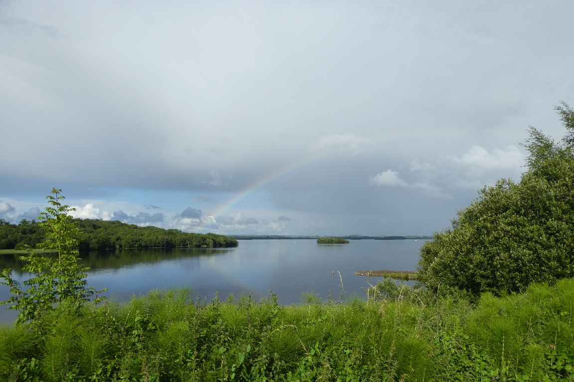
Der Fluss Erne (An Éirne) entspringt in der Grafschaft Cavan und durchfließt auf seinen 120 Kilometern mehrere Seen, wie den Lough Gowan und den Oberen und Unteren Lough Erne (Loch Éirne), bis er kurz nach Ballyshannon im Meer mündet. Speziell in seinem oberen Einzugsgebiet gibt es aber eine Unzahl kleiner Seen, die mit dem Erne auf natürliche Weise verbunden sind. Daneben gibt es noch einige künstliche Verbindungen, wie den Shannon-Erne-Wasserweg. Der größte der Seen ist mit einer Länge von etwa 30 Kilometer der Untere Lough Erne. Städte gibt es an seinen Ufern keine, aber Dutzende Inseln sind über die ganze Seeoberfläche verstreut. In seinem Westteil führt die A46 immer wieder dicht an das Ufer heran, z. B. in der Nähe von Church Hill, wo uns das regnerische Wetter des Tages wieder einmal seine bunte Seite zeigt.
The River Erne (An Éirne) originates in the County Cavan and on its 120 kilometres runs through several lakes, like Lough Gowan and the Upper and Lower Lough Erne (Loch Éirne), until it flows into the sea a short way after Ballyshannon. Especially in the upper catchment area there are a plethora of smaller lakes that are connected to the Erne in natural ways. Additionally there are some artifical connections like the Shannon-Erne-Waterway. The largest of the lakes is, with a length of about 30 kilometres, the Lower Lough Erne. There are no towns on its banks, but dozens of isles scattered over its whole surface. In its western part the A46 leads often close to its banks, like in the proximity of Church Hill, where the rainy weather of that day shows off with its colourful side.
Zugeordnete Themen / Assigned Topics:

Mehr Informationen über - Unterer Lough Erne / More information about - Lower Lough Erne
Lage / Location
Irish grid: H 13114 55655


