Ballyshannon Kraftwerk / Ballyshannon Power Station
(2017-07-22)
Bei der Bootsfahrt nach White Island erzählt uns der Skipper eine Geschichte: Im 2. Weltkrieg (The Emergency - der Notfall, wie er in Irland hieß) nutzten die Alliierten den unteren Erne See in Nordirland als Basis für ihre Wasserflugzeuge. Wegen der Windrichtung mussten sie nach Westen starten und damit das Hoheitsgebiet der Republik überfliegen. Dazu brauchten sie die Erlaubnis Dublins, das jedoch offiziell neutral war. Aber da alles verhandelbar ist, einigten sich die Iren und die Briten darauf, dass die Republik die Überflüge tolerieren und dafür die Wasserrechte am Fluss Erne bekommen würden.
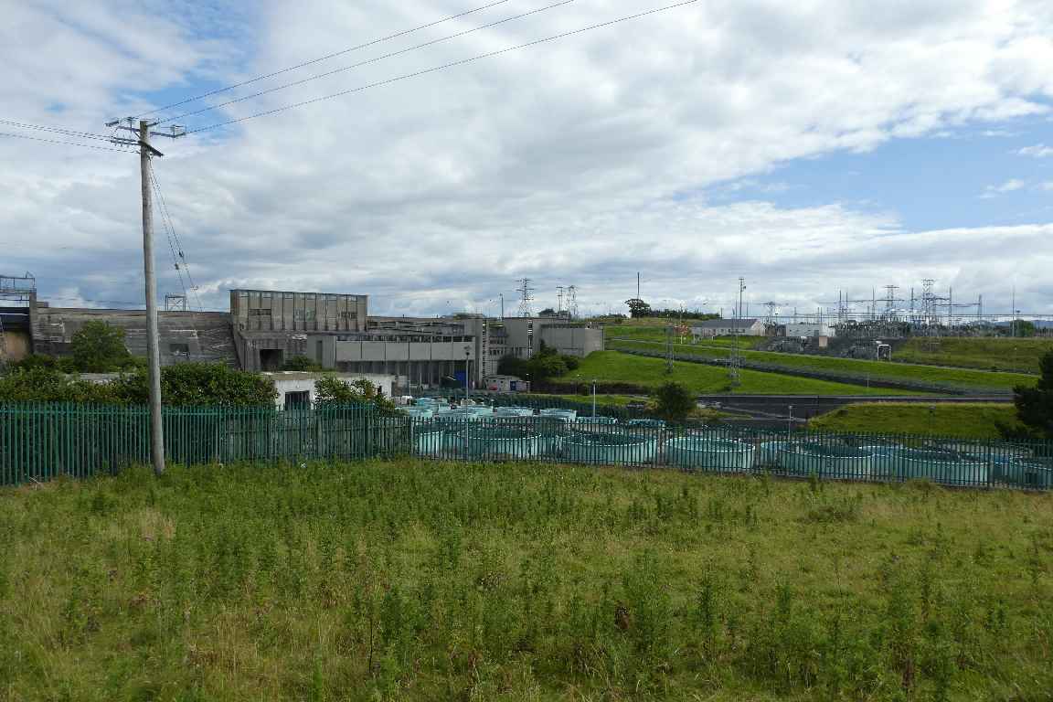
Das Ballyshannon Kraftwerk war die erste große Zusammenarbeit zwischen Dublin und Belfast nach der Unabhängigkeit der Republik. Die Arbeiten begannen 1946 und wurde 1955 beendet. Der Erne wird mit zwei Dämmen aufgestaut. Die Turbinen dieser Staustufen erzeugen 65 Megawatt und versorgen 38.000 Haushalte.
During the boat trip to White Island the skipper tells us a story: During the 2nd World War (The Emergency, as it is called in Ireland) the Allied Forces used Lower Lough Erne in Northern Ireland as base for their waterplanes. Because of the direction the wind blows they had to start towards the west and therefore fly over the territory of the Republic. For that they needed the permission of Dublin, which however was neutral. But because everything is negotiable, the Irish and the British came to the agreement that the Republic would tolerate the flyovers in exchange for the water rights of the River Erne.
The Ballyshannon Power Station was the first large co-operation of Dublin and Belfast after the independence of the Republic. The construction began in 1946 and was completed in 1955. There are two dams across the River Erne. The turbines of these barrages create 65 megawatts and supply 38,000 homes.
Zugeordnete Themen / Assigned Topics:
Mehr Informationen über - Ballyshannon Kraftwerk / More information about - Ballyshannon Power Station
- esbarchives.ie/portfolio/river-erne/
- Wikipedia (en): Cathaleen's Fall hydroelectric power station
- www.buildingsofireland.ie/buildings-search/building/40852084/cathleens-falls-hydroelectric-power-station-townparks-ballyshannon-county-donegal
- www.esb.ie/education-hub/useful-links-and-documents
- www.historyireland.com/volume-22/erne-hydroelectric-scheme/
Lage / Location
- Irish grid: G 88730 61240


