Beara Halbinsel / Beara Peninsula
(2015-07-11)
Die Beara (Béarra) Halbinsel ist die mittlere der fünf Halbinseln im Südwesten Irlands. Sie war einst das Herrschaftsgebiet des O'Sullivan Beare Clans, bis sie Anfang des 17. Jahrhunderts von den Engländern erobert wurde. Mehrere Jahrtausende wurde auf der Beara Kupfer abgebaut, was sie für den jeweiligen Herrscher sehr attraktiv machte.
Cork und Kerry teilen sich die Beara, die Grenze läuft über den Kamm der Caha Berge mit dem höchsten Gipfel Hungry Hill (685 Meter). Der Ring of Beara führt um die gesamte Halbinsel, ist aber für Busse und schwere Fahrzeuge gesperrt. Für Wanderer gibt es fast parallel dazu den Beara Way.
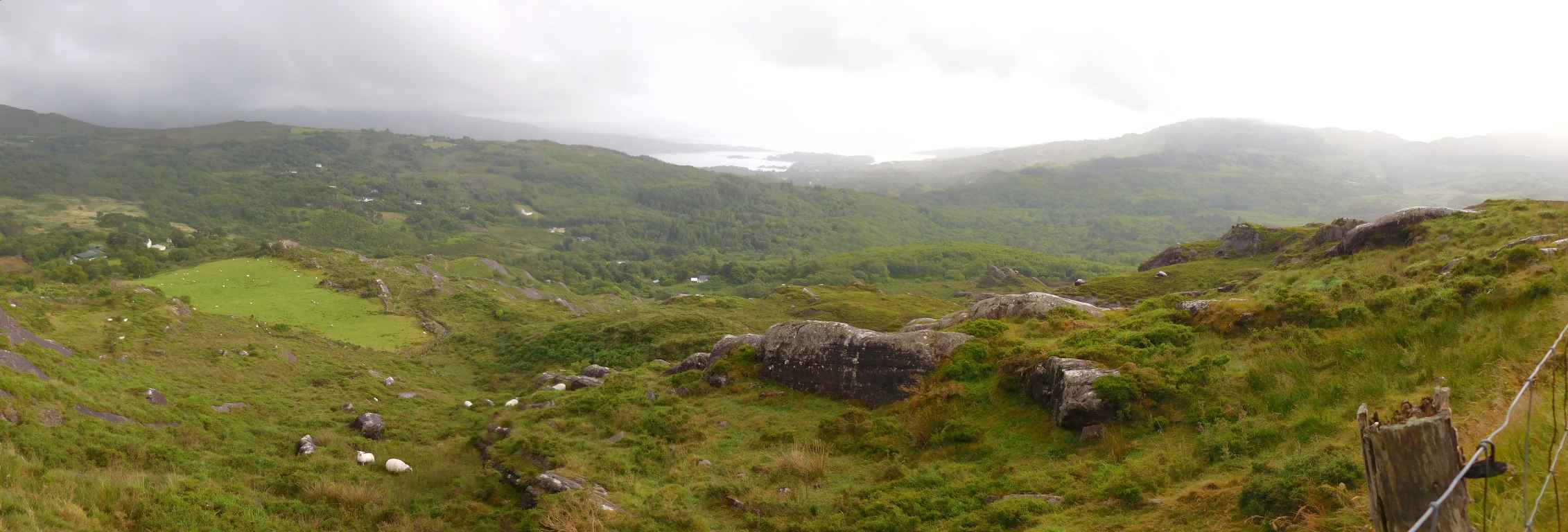
Bei der Fahrt von Glengarriff nach Kenmare haben wir einen wunderbaren Blick über die für die Gegend typische Landschaft mit grünen Wäldern und Wiesen, wollige Schafe zwischen kahlen Felsen und natürlich Regen. Die Bantry Bucht ist in der Bildmitte, rechts davon schon die ersten Spitzen der Caha Berge auf der Beara Halbinsel.
The Beara (Béarra) peninsula is the middle one of the five peninsulas in the south-west of Ireland. It was once the domain of the O'Sullivan Beare clan, until it was conquered by the English at the beginning of the 17th century. For several thousand years copper was mined on the Beara, which made it very attractive to the respective ruler.
Cork and Kerry share the Beara, the border runs over the crest of the Caha Mountains with its highest peak, Hungry Hill (685 metres). The Ring of Beara (which is part of the Wild Atlantic Way) leads around the whole peninsula, but is off-limits for coaches and heavy vehicles. For hikers there is the almost parallel running Beara Way.
While driving from Glengarriff to Kenmare we have a great view over the landscape, which is typical for this area with green forests and meadows, woolly sheep between bare rocks and of course rain. The Bantry Bay in the middle of the picture, to the right the first peaks of the Caha Mountains on the Beara peninsula can be seen.
Mehr Informationen über - Beara Halbinsel / More information about - Beara Peninsula
Lage / Location
- Irish grid: V 91540 58300


