Gap of Dunloe
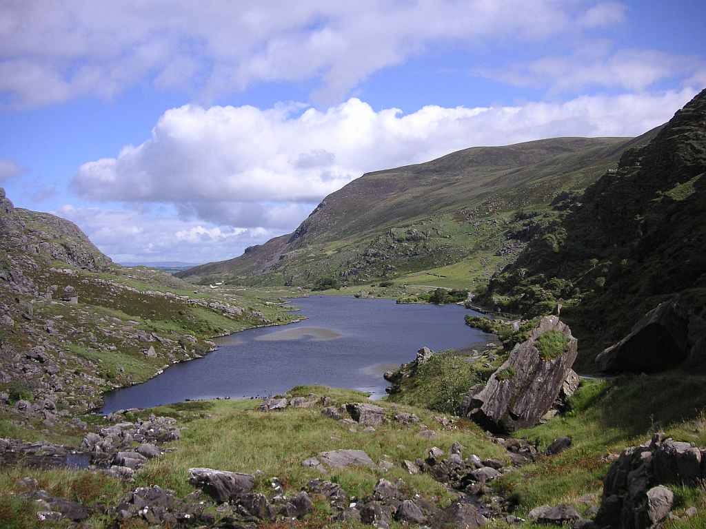
Auger Lake
(2012-08-21)
Bis zum dritten See, dem Auger Lake, ist die Straße noch einfach begehbar. Ab dann wird sie so steil, dass die Pferdekutschen nicht mehr fahren. Wir lassen sie bei ein paar Ruinen am Ufer des Sees hinter uns. Oberhalb des Turnpike Stones (Mautstein, der schräg stehende rechts im Bild) lohnt sich ein Blick zurück in das Tal.
Until the third lake, Auger Lake, the road is easy to walk. After that, it becomes so steep that the jaunting cars do not go further. We leave them behind at a few ruins at the lakeshore. Above the Turnpike Stone (the tilted one on the right side of the picture) a look back into the valley is very rewarding.
Übersicht über Gap of Dunloe / Overview of Gap of Dunloe
 Auger LakeSerpent LakeMacgillycuddy's Reeks
Zugeordnete Themen / Assigned Topics:
Lage / Location
Irish grid: V 87630 85770


