Mulroy Bucht / Mulroy Bay
(2017-07-23)
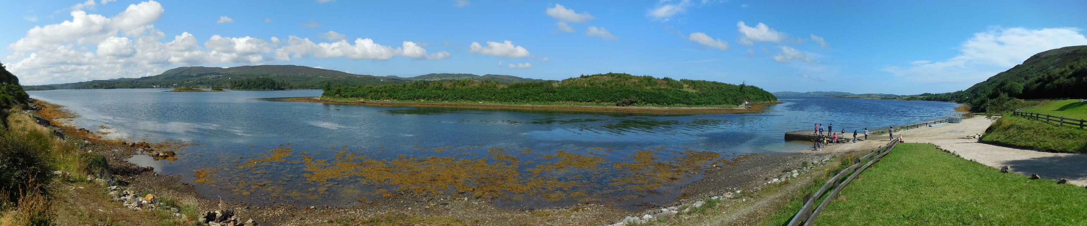
Die Mullroy Bucht (Cuan na Mhaoil Ruaidh, Bucht der roten Strömung) trennt die Halbinseln Fanad und Rosguill. Auf der Karte hat die Bucht ein sehr fraktales Aussehen: ausgefranst und verästelt. Am Südende liegt die Stadt Millford (Baile no nGallóhlach) - mehr als 20 Kilometer vom Meer entfernt. Wir machen auf unserer Fahrt entlang des Mulroy Drives eine kurze Rast auf einem Parkplatz südlich der Stadt Carrowkeel (An Cheathrú Chaol), um ein paar Fotos zu schießen. Die Inseln in der Bucht, die wir hier sehen, sind ein Vogelschutzgebiet.
Mullroy Bay (Cuan na Mhaoil Ruaidh, bay of the red current) separates the peninsulas of Fanad and Rosguill. On the map the bay has a very fractal form: Frayed and ramified. On it south end lies the town of Millford (Baile no nGallóhlach) - more than 20 kilometres away from the sea. On our trip along the Mulroy Drive we have a short break on a parkingplace south of the town of Carrowkeel (An Cheathrú Chaol) to shoot a few photos. The isles that we can see in the bay are a bird sancutary.
Zugeordnete Themen / Assigned Topics:

Mehr Informationen über - Mulroy Bucht / More information about - Mulroy Bay
Lage / Location
Irish grid: C 20118 30468


