Glenveagh Nationalpark / Glenveagh National Park
Lough Beagh
(2022-07-06)
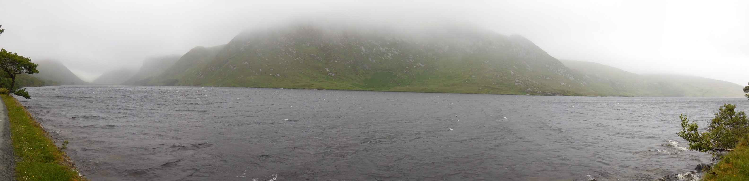
Lough Beagh (Lough Gleann Bheatha) liegt langgestreckt im Tal des Flusses Owenveagh eingebettet zwischen den Derryveagh Bergen (Slléibhte Dhoire Bheatha, im Bild) und den Bergen Altachoastra und Kinneveagh (Cionn an Bheithe). Der National Park erstreckt sich aber noch weit in den Süden, im Osten fast bis zum Lough Gartan und im Westen bis zum Gebiet um den Berg Crocknafarragh. Im Besucherzentraum an der Nordseite steht ein dreidimensionales Modell der Landschaft, das einen guten Eindruck von der Größe des National Parks vermittelt.
Lough Beagh (Lough Gleann Bheatha) lies strung out in the valley of the Owenveagh River embedded between the Derryveagh Mountains (Slléibhte Dhoire Bheatha, im Bild) and the mountains Altachoastra and Kinneveagh (Cionn an Bheithe). The National Park goes far to the south, in the east almost to Lough Gartan and in the west to the area around Crocknafarragh Mountain. In the Visitors Centre at the northern border there is a three dimensional model of the landscape that gives us a good impression of the size of the National Park.
Zugeordnete Themen / Assigned Topics:

Mehr Informationen über - Lough Beagh / More information about - Lough Beagh
Lage / Location
Irish grid: C 01890 21205
Übersicht über Glenveagh Nationalpark / Overview of Glenveagh National Park


(© OpenStreetMaps contributors)